Veriler
Azerbaycan İlleri
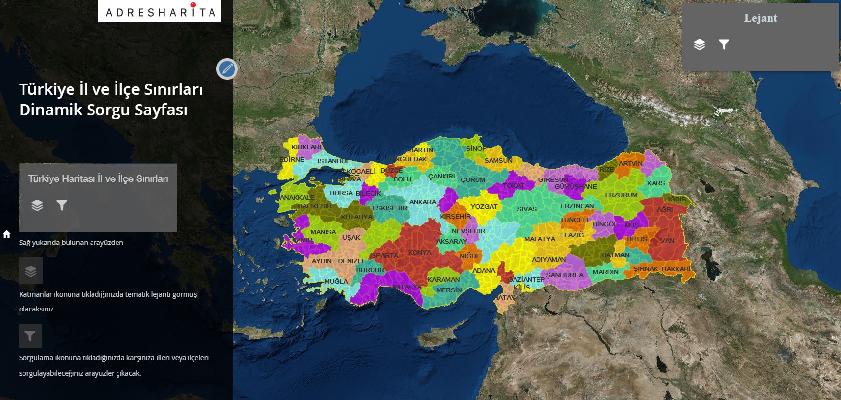
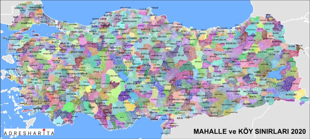
Türkiye Mahalle ve Köy Sınırları
Türkiye Mahalle Sınırları Verisi
Türkiye’de bulunan tüm mahalle ve köylerin sınırlarını gösteren vektörel ve sayısal veri setidir. AVT’ye kayıtlı tüm köy ve mahalleleri kapsar. Ülkemizde 32.006 mahalle ve 18.337 köy bulunmaktadır. Bunlara bağlı mezra ve mevkilerin sayısı 23.955’tir ve herhangi bir idari sınırla tanımlanmamıştır.
Teknik Özellikler
- UAVT’ye kayıtlı tüm köy ve mahalleleri kapsar.
- WGS-84 koordinat sisteminde, SRID=4326.
- Data formatları: Esri ShapeFiles, SQL, Access (mdb), kml-kmz, GeoDatabase (gdb), JSON, SVG, PDF.
- 1 gün içinde e-mail ile teslim.
- Tüm Türkiye, il il, ilçe ilçe temin edilebilir.
- Veriyi harita aracında görselleştirmek için mahalle sınırları verisi temin edilebilir.
- Yılda 2 defa güncellenir. Güncellemeler veri fiyatının %20’sidir.
Veri Güncelleme
1 yıl içinde verileri tekrar alan kullanıcılar bedelinin %25’ini öder. Böylece yıllar içinde her zaman güncel ve doğru veriyi uygun bütçe ile yönetirler. Adres Harita Ltd., ürettiği her veriyi UAVT kodları ile uyumlu yapmaktadır. Geçmiş ve gelecekteki verilerle çalışmalarınızda içiniz rahat olsun. Geçmişe yönelik verileri de temin etmekteyiz.
Türkiye’nin idari yapısı hakkında detaylı bilgi için iletişime geçebilirsiniz.
Türkiye Mahalle Sınırları Verisi, Türkiye Mahalleleri, Mahalle Sınırları, Mahalle Verisi.
Sayısal Mahalle ve Köy Sınırları

Mahalle ve köy sayısal sınır veri seti.
Sayısal Türkiye İlçe Haritası

Türkiye ilçe sınırlarının sayısal haritası.
Türkiye Neighborhood Boundaries | Professional Map Database
Digital map layers prepared at the street and avenue level are integrated with neighborhood and district boundary data; Export in GeoJSON, SHP, KML and KMZ formats is supported and is compatible with the geodatabase used by experts in the field and in the office.
Digital data layer prepared for neighborhood and village boundaries; It comes with location accuracy, street references and development indices; Optimized for use on multiple platforms with support for data formats GeoJSON, SHP, KML and KMZ.
This neighborhood map was prepared with comprehensive geographic and location information and includes neighborhood boundaries, street and avenue details, development indicators and digital layers; It also offers professional, expert-focused data in geodatabase-compatible, vector and digital formats that can be integrated with shapefiles such as KML, KMZ, GeoJSON and SHP.
Professional location and street map service
We offer accurate digital maps, GeoJSON and SHP compatible geographic data, district and neighborhood boundaries, and development analyses. The solution for experts who want to have maps made or purchase data.
Geographic data for development & location analysis
District map, neighborhood development data, village boundary and street layers; Delivery in KML/KMZ/GeoJSON/SHP formats. Contact for professional projects.
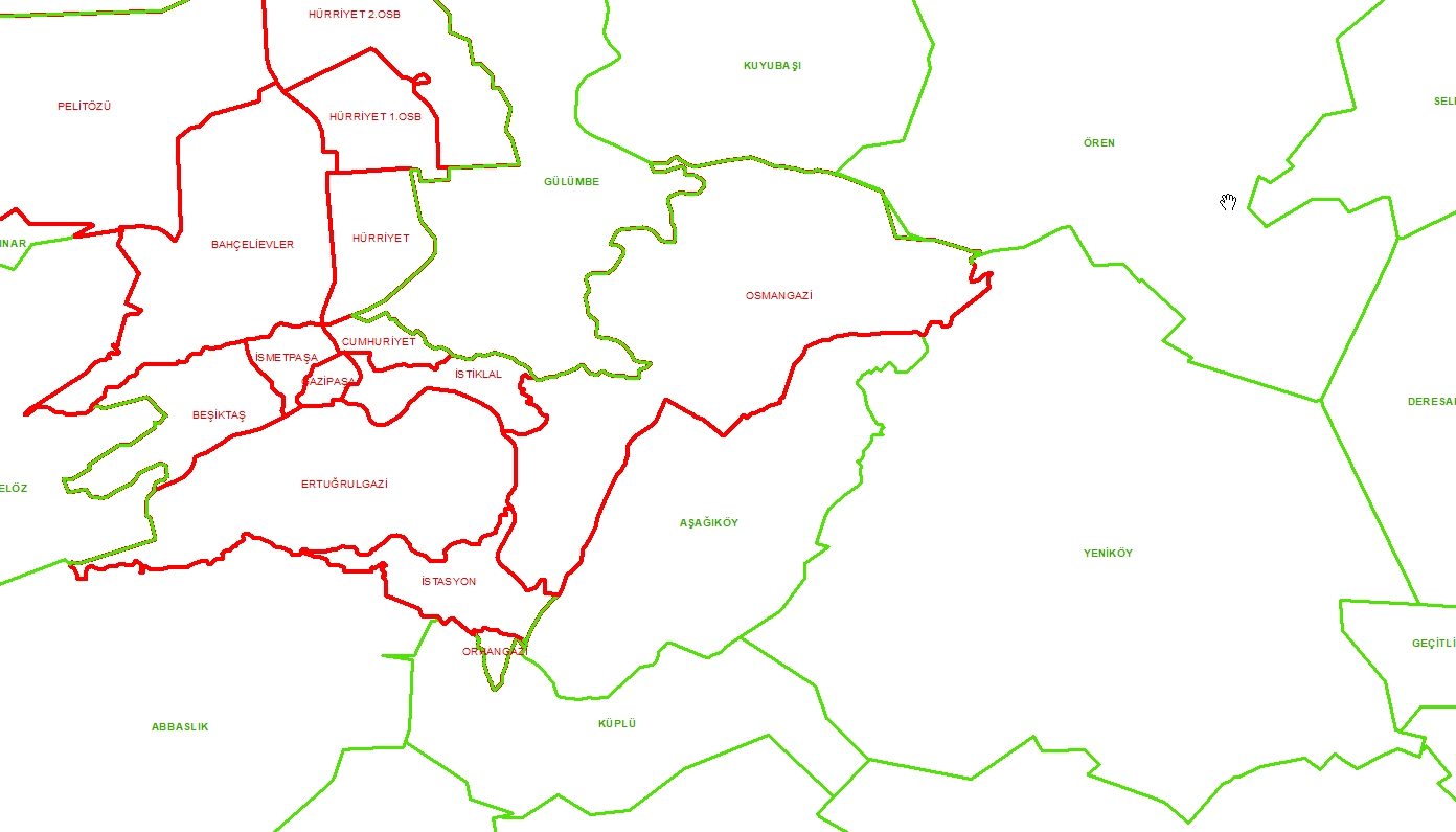
Türkiye Mahalle Sınırları

Türkiye mahalle idari sınır haritası.
Mahalle Temelli Temel Versiyon Görseli

Mahalle tabanlı harita temel görseli.
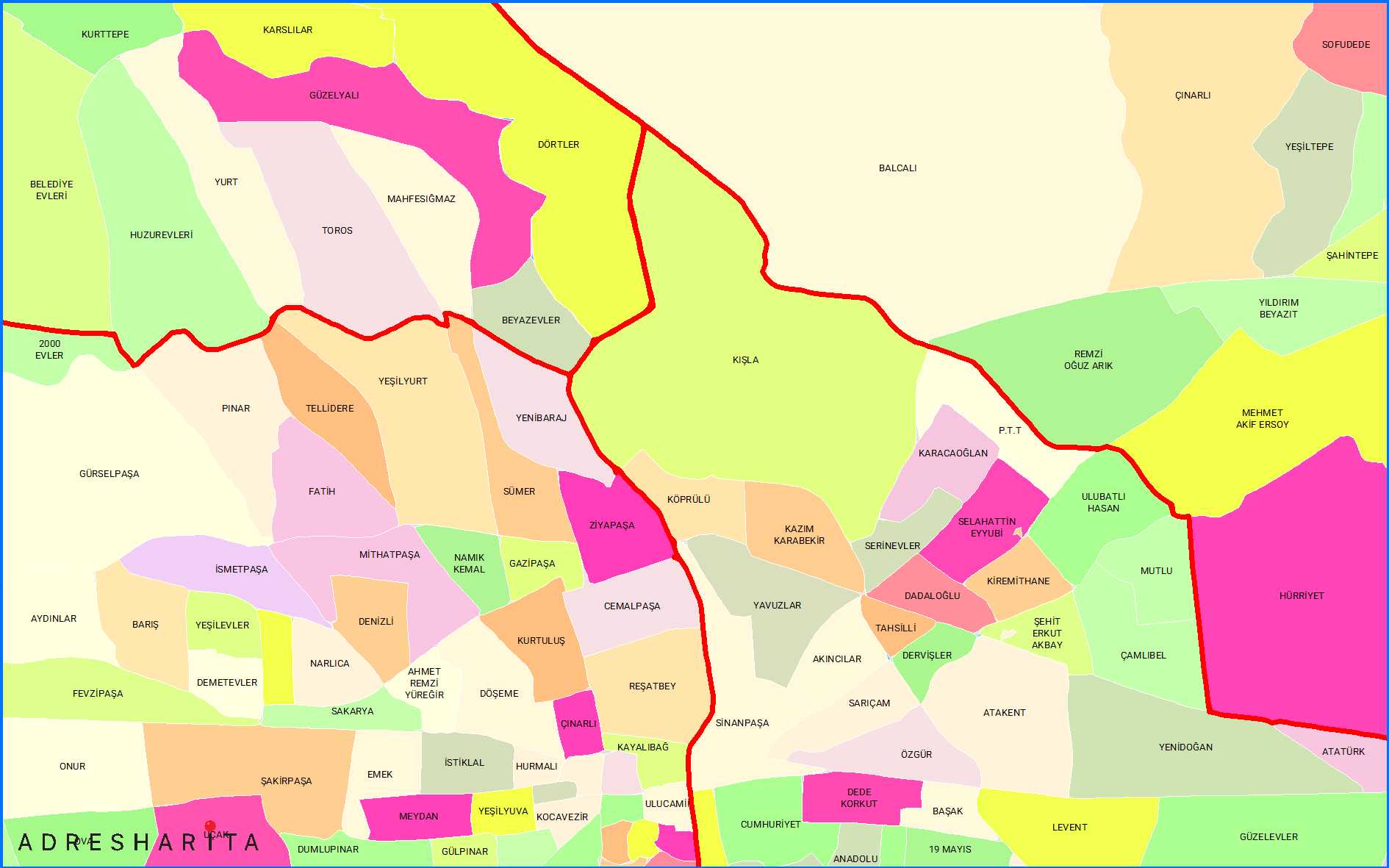
Mahalle Haritaları

Mahalle sınır haritaları koleksiyonu.
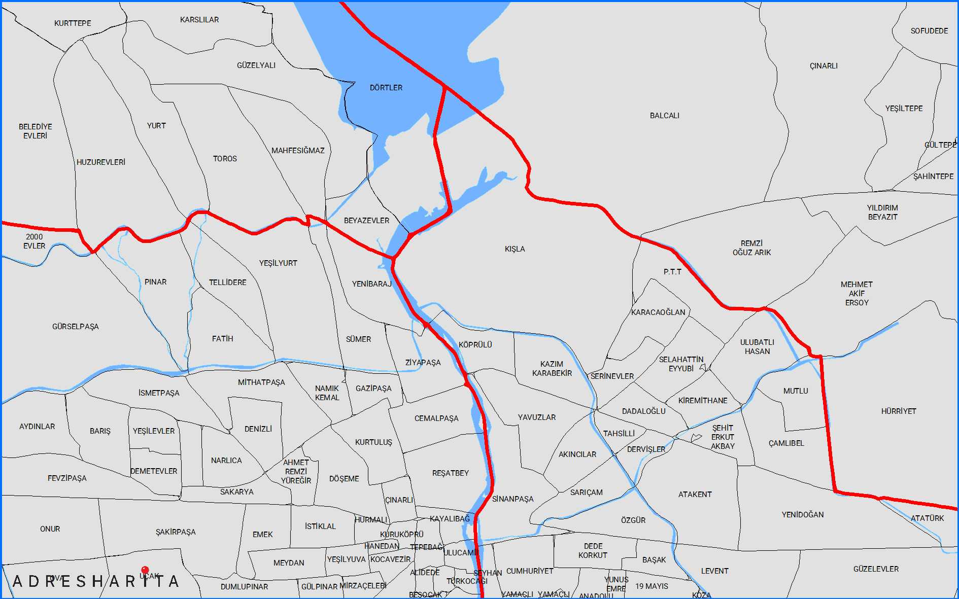
Sayısallaştırma Haritaları

Sayısallaştırılmış bölge haritaları seti.
Turkiye Mahalle Snirlari Scaled

Ölçeklendirilmiş Türkiye mahalle sınırları haritası.
NEIGHBORHOOD BOUNDARIES
Turkey Neighborhood Borders Data
It is vector and numeric data showing the borders of all neighborhoods and villages in Turkey.
It covers all villages and neighborhoods registered to AVT. There are 32,006 neighborhoods and 18,337 villages in our country. The number of hamlets and localities connected to them is 23,955 and they are not defined by any administrative borders.
TRNC Neighborhood Borders Data
It is the vector format of TRNC administrative structure and borders data.
This data presents the neighborhoods listed by the TRNC Ministry of Internal Affairs in vector form.
TECHNICAL SPECIFICATIONS
It covers all villages and neighborhoods registered to UAVT. There are 32,006 neighborhoods and 18,337 villages in our country. The number of hamlets and locations connected to them is 23,955 and they are not defined by any administrative borders.
It is in the WGS-84 coordinate system. SRID=4326. (Click for the most used projections)
Data can be obtained in Esri ShapeFiles, SQL, Access (mdb), kml-kmz, GeoDatabase(gdb), Json, Svg, Pdf formats.
It is delivered by e-mail within 1 day.
You can obtain it for all of Turkey, province by province, district by district. If you do not have neighborhood border data to visualize the data you receive on a map tool, you can obtain it from AdresHarita.
It is updated twice a year. Updates are 20% of the data price.
You can contact us for details about the administrative structure of Turkey.
Türkiye Neighborhood Boundaries Data – Türkiye Neighborhoods – Neighborhood Boundaries – Neighborhood Data
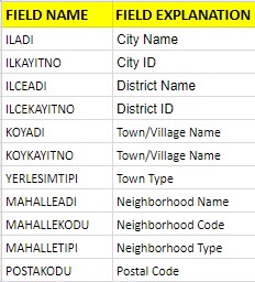
DISTRICT TABLE STRUCTURE
| DOMAIN NAME | DOMAIN DESCRIPTION |
|---|---|
| ILADI | Province Name |
| ILKAYITNO | Province Registration Number |
| ILCEADI | District Name |
| ILCEKAYITNO | District Registration Number |
| SETTLETYPE | Nature of Settlement |
| POSTACODE | Postal Code |
MAHALLE SINIRLARI
SCREENHUNTER 663 MAY. 30 15.46
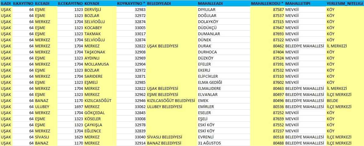
NEIGHBORHOOD BOUNDARIES TABLE STRUCTURE
| AREA NAME | AREA DESCRIPTION |
|---|---|
| ILADI | Province Name |
| ILKAYITNO | Province Registration Number |
| ILCEADI | District Name |
| ILCEKAYITNO | District Registration Number |
| KOYADI | Name of the Settlement Where It Is Located |
| KOYKAYITNO | Village Registration Number |
| NEIGHBORHOODNAME | Neighborhood Name |
| NEIGHBORHOODCODE | Neighborhood Number |
| NEIGHBORHOODTYPE | Neighborhood Type |
| SETTLETYPE | Quality of Settlement |
| POSTALCODE | Postal Code |
MAHALLE SINIRLARI TEMEL VERSİYON
MAHALLE SINIRLARI VERISI
MH EN
TURKİYE İL İLCE SİNİRLARİ HARİTASİ
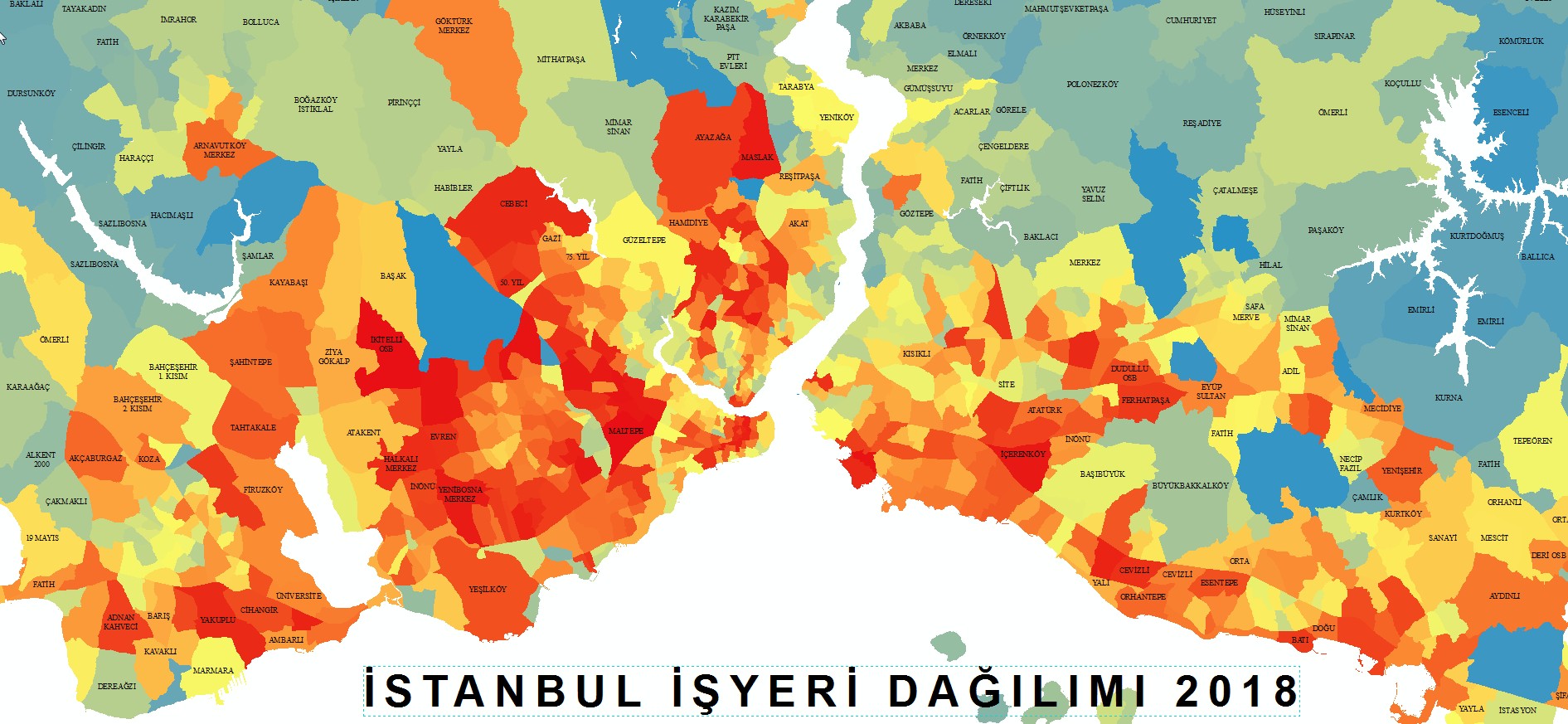
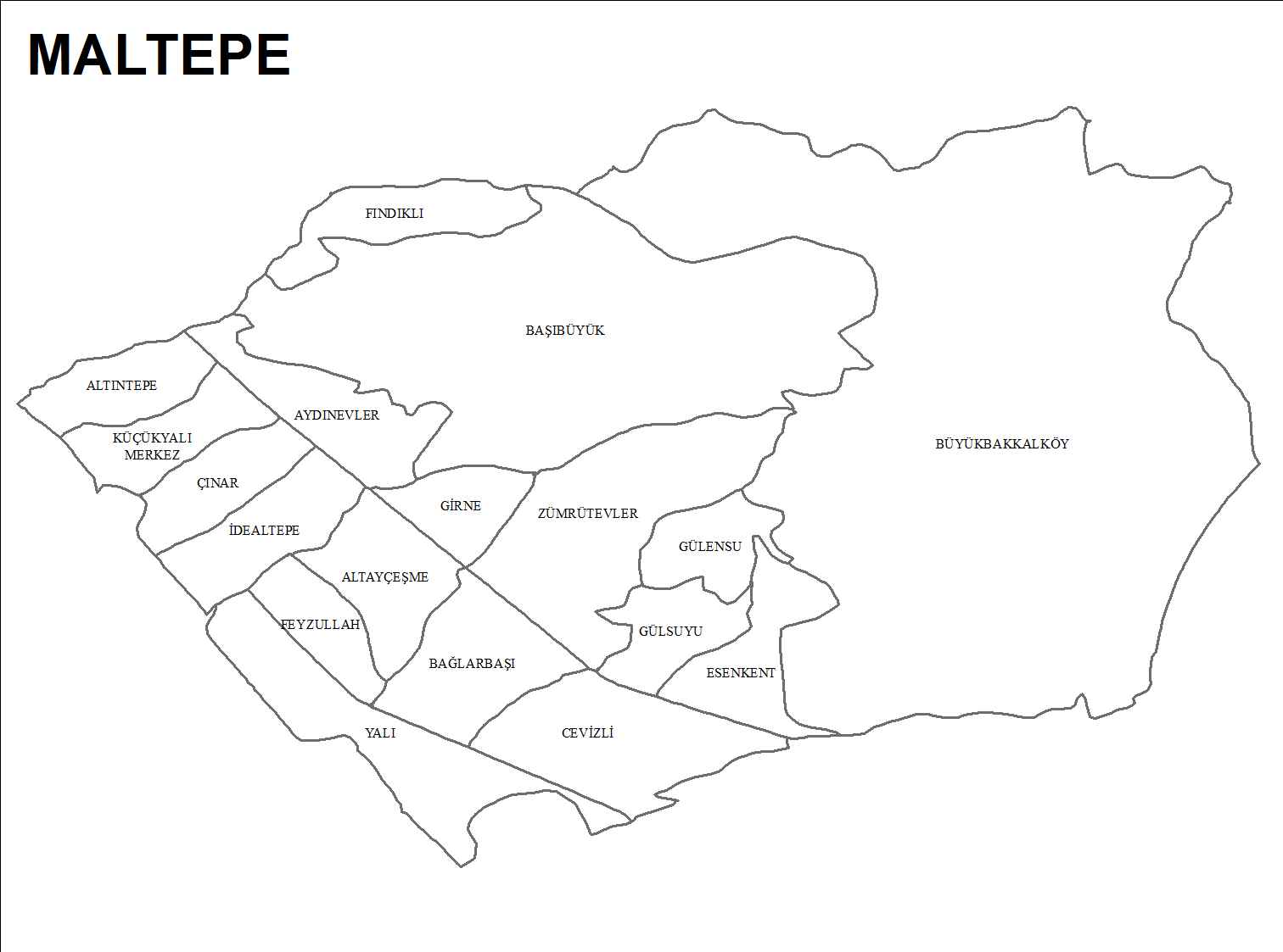
MALTEPE SAYISAL ILCE
TURKIYE MAHALLE SNIRLARI SCALED E1589906472119
MAHALLE